CHAPTER III-3
FLOOD HAZARD MAPPING PROGRAM
INTRODUCTION
The National Flood Insurance Program (NFIP) is designed to enable property owners in participating communities to purchase insurance as a protection against economic losses related to flooding in exchange for State and community Floodplain Management Regulations that mitigate future flood damage losses. The main tool for this program is the associated Flood Insurance Rate Maps (FIRMs) produced by the NFIP. To be an effective tool for communities to practice sound floodplain management, these maps need to designate appropriate levels of flood risks along all major streams and also provide accurate data regarding such flood risks. Due to the national extent and limitations of the mapping initiative by the NFIP, there are many stream reaches in the Maumee River Basin that either do not have a compatible floodplain designation or are based on data that is too general to provide accurate flood limits and/or are outdated. The 2008 Master Plan update provides an opportunity to identify the stream reaches without compatible or accurate mapping and to develop a prioritization protocol for creating a more comprehensive Flood Hazard Identification Program to accurately map flood risks within the Basin.
1995 MASTER PLAN REVISITED
The 1995 Master Plan identified two major restudy needs, Fairfield Ditch and Junk Ditch. In addition, subsequent to the completion of the 1995 plan, MRBC added a Flood Hazard Identification Program and started implementing this program by initiating and completing several floodplain studies throughout the watershed.
MRBC ACCOMPLISHMENTS
To accomplish its goals, MRBC became one of the first entities in Indiana to become a Cooperating Technical Partner (CTP) with FEMA and started to study a large number of streams within the watershed, with cost-share funding from FEMA. The following is a list of flood hazard identification studies initiated and/or completed by MRBC since 1995:
- Detailed study and subsequent calibration of St. Marys River from mouth in Allen County upstream through Adams County to Indiana-Ohio state line.
- Steuben County Countywide Map Modification (these map modifications included approximate studies and redelineations of several streams and lakes throughout the County per scoping by Indiana Department of Natural Resources (IDNR))
- Noble County Countywide Map Modification (these map modifications included approximate studies and redelineations of several streams and lakes throughout the County per scoping by Indiana Department of Natural Resources (IDNR))
- Adams County Countywide Map Modification (included redelineations and additional approximate level stream studies.)
- Detailed study of Hoffman Ditch in Allen County from mouth to one square mile drainage area cutoff
- Detailed study of Black Creek in Allen County from mouth to Trammel Road
- Detailed study of Flatrock Creek in Allen County from state line to state line
- Detailed study of Big Run Creek in DeKalb County through City of Butler
- Detailed study of a reach of Eley Drain in Noble County in and near Town of Avilla
- Detailed study of Van Gorder Ditch in Noble County in and near Town of Avilla
- Detailed study of Marsh Ditch in Allen County from mouth to confluence with Hetrick Ditch
- Detailed study of Fairfield Ditch in Allen County from mouth to Lower Huntington Road
- Detailed study of Little Cedar Creek in DeKalb and Noble Counties from mouth to northernmost crossing of Noble-DeKalb County line
- Detailed study of Fish Creek in DeKalb County from Indiana-Ohio State line to DeKalb-Steuben County line
- Detailed study of Hiram Sweet Ditch in DeKalb and Steuben Counties from mouth to the Hamilton Lake outlet (this stream reach had earlier been processed under “Fish Creek”)
- Detailed study of Cedar Creek in Allen and DeKalb Counties from mouth to Cedar Lake
- Detailed study of Black Creek in DeKalb and Noble Counties from mouth to County Road 300 South
- Detailed study of Peckhart Drain in DeKalb County from mouth to County Road 40
- Detailed study of Diehl Drain in DeKalb County from mouth to County Road 15
- Detailed study of Roy DeLagrange Ditch in Allen County from Auburn Road to upstream of State Road 327
- Detailed study of St. Joseph River in Allen and DeKalb Counties from mouth to Indiana-Ohio State line
- Detailed study of Maumee River in Allen County from mouth to Indiana-Ohio State line
- Detailed study of Blue Creek in Adams County from mouth to US 27
- Detailed study of Yellow Creek in Adams County from mouth to County Road 10½ (CR 250 N)
Despite the improvements to the flood hazard mapping accomplished by MRBC to date, there are still several issues regarding the mapping of such flood risk areas that communities within the basin face. Some of these issues are:
-
There are still several miles of stream within the watershed where no floodplain is shown. Someone seeking to develop one of these areas therefore may assume there is no flood hazard and build without adequate protection for the real hazard. Communities need the flood hazard risk identified in order to enforce proper building requirements that reduce/prevent flood damage.
-
Some stream reaches have a detailed study but the modeling was based on a limited amount of detailed data and therefore does not accurately calculate the expected flood elevations. Communities may then end up allowing structures to be built without proper flood protection.
-
Some stream reaches have a detailed study but the discharges used were not appropriate. This could be due to a limited level of information being available when the discharges were selected. Additional years of records sometimes provide information to indicate the expected discharges no longer appear appropriate. Again, communities may then end up allowing structures to be built without proper flood protection.
-
Stream reaches may have a reasonable detailed hydraulic model but limited topographic data for use in delineating the floodplain. This would results in high ground being mapped in the floodplain and / or low ground being mapped outside of the flood risk area. Communities would therefore be regulating floodplains that don’t reasonably reflect the real flood risk.
-
Stream reaches may have detailed hydraulic modeling but significant changes in the topography or obstructions (such as levees or restrictive bridges) have occurred since the study input data was collected.
To assist MRBC in identifying and prioritizing the areas where improved floodplain mapping is needed, information was gathered and GIS layers were created to develop a comprehensive GIS based tool for evaluating options and determining priorities for further floodplain studies. MRBC chose to focus its efforts to “major” stream reaches within the watershed, with the upstream end of a “major” stream reach defined as the point at which the contributing drainage area is equal to or larger than one square mile (640 acres). The first significant step was to determine the location of one-square mile cutoff point along each stream. This was accomplished through trial and error utilizing StreamStats, a web-based stream discharge calculation tool developed by USGS. Once the one square mile cutoff points were determined, the “major” (>1 square mile in drainage area) stream reaches with no floodplain designation were identified. Also identified for each stream were the portions of the stream with existing approximate, detailed study, in backwater of receiving stream, or shaded Zone X floodplain mapping designations.
The following table shows a summary of the total stream reach lengths for each floodplain designation by County.
COUNTY |
STREAM REACH CLASSIFICATION AND TOTAL MILES IN THE MAUMEE RIVER BASIN |
|||||
Detailed Study |
Approximate Floodplain |
No Floodplain Information |
In Backwater of Receiving Stream |
Shaded Zone X Floodplain |
TOTALS |
|
Adams |
48.61 |
76.85 |
102.59 |
16.31 |
0.00 |
244.4 |
Allen |
246.0 |
55.8 |
125.8 |
22.1 |
1.2 |
450.9 |
DeKalb |
67.8 |
126.4 |
73.6 |
5.1 |
0.0 |
273.0 |
Noble |
16.5 |
0.0 |
25.2 |
1.6 |
0.0 |
43.3 |
Steuben |
1.0 |
34.3 |
20.9 |
0.1 |
0.0 |
56.4 |
Wells |
0.0 |
1.9 |
3.3 |
0.0 |
0.0 |
5.2 |
TOTALS |
379.9 |
295.3 |
351.4 |
45.2 |
1.2 |
1073.1 |
FLOODPLAIN STUDY PRIORITIZATION CRITERIA
In order to be able to determine the appropriate course of action for each stream reach and then prioritize actions to be pursued, various stream reaches were further categorized into several categories as follows:
Category |
|
Description |
1 |
|
Stream reaches with no floodplain designations that are currently located within a municipality’s boundary and/or are within the municipality’s expected growth areas as determined through zoning maps, utility service areas or their expansion plans, and/or as recommended by the municipality’s planning and zoning officials. |
2 |
|
Stream reaches with no floodplain designations that are not currently within a municipality or its expected growth area. |
3 |
|
Stream reaches with floodplain designations that are believed to have suspect accuracy and/or need to be updated due to changes in topography, discharges, crossings, stream cross sectional areas, and/or stream alignment as well as cases where the accuracy of the current mapping is suspect as a result of an evaluation that may have identified needed improvements due to deficiencies in the existing modeling or use of outdated or less detailed information in developing the existing floodplain designations (this is often times evidenced by receiving a lot of complaints or noticing issuance of an unexpectedly large number of FEMA LOMAs for the stream reach). |
4 |
|
Stream reaches with approximate floodplain designations that are located within a municipality’s boundary or its expected growth areas. |
5 |
|
Stream reaches with floodplain designations that have previously been studied as approximate or detailed study through an MRBC-supported initiative. |
6 |
|
Other previously studied stream reaches within the Maumee River Basin with approximate floodplain designations |
7 |
|
Other previously studied stream reaches within the Maumee River Basin with detailed floodplain designations. |
8 |
|
Stream reaches with less than 1 square mile of drainage area. |
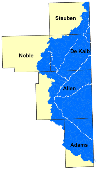
The following exhibit highlights stream reaches in various categories.
The following table shows a summary of the total stream reach lengths for each category by County.
COUNTY |
TOTAL MILES OF STREAM REACHES IN EACH CATEGORY |
|||||||
1 |
2 |
3 |
4 |
5 |
6 |
7 |
8 |
|
Adams |
6.5 |
90.3 |
0 |
26.2 |
68.3 |
28.9 |
4.6 |
164.9 |
Allen |
18.9 |
106.9 |
0 |
23.8 |
127.4 |
53.7 |
120.2 |
338.3 |
DeKalb |
2.4 |
71.2 |
5.1 |
10.6 |
71.7 |
115.7 |
0 |
150.5 |
Noble |
0 |
25.2 |
0 |
0 |
16.5 |
1.6 |
0 |
30.1 |
Steuben |
1.2 |
19.7 |
0 |
4.9 |
16.7 |
13.9 |
0 |
61.8 |
Wells |
0 |
3.3 |
0 |
0 |
0 |
1.9 |
0 |
4.4 |
TOTALS |
29.1 |
316.6 |
5.1 |
65.4 |
300.6 |
215.7 |
124.8 |
750.0 |
Note that currently only a small number of stream reaches have been identified in Category 3. The number of stream reaches and the associated total lengths in this category are expected to increase as the needs are identified throughout the implementation period. Also note that the stream reaches and the associated total length of stream reaches currently shown under Category 4 do not include stream reaches that would be added to this category as new approximate studies are completed for the Category 1 and 2 stream reaches. As the approximate studies associated with the Category 1 and 2 stream reaches are completed and growth areas expand, many of these stream reaches will need to be added to the Priority 4 category to be upgraded to detailed studies at a later time.
Based on discussions with the steering committee and MRBC experience, the following actions are recommended in the order of priority.
-
Perform approximate floodplain studies for the stream reaches in categories 1 and 2. The objective is to have at least a preliminary regulatory floodplain designation along these stream reaches with the least cost possible, which would typically result in an approximate Zone A designation for the stream reach. The cost associated with generating a mile of approximate floodplain designation is expected to be less than one tenth of that required for performing a detailed study, making it possible for MRBC to economically afford to designate a regulatory zone along these study reaches in a relatively short amount of time.
-
Perform new or updated detailed floodplain studies for stream reaches in categories 3 and 4. The objective is to have accurate, detailed, and reliable floodplain information, complete with floodway, BFE information, multi-flood profiles, and 0.2% Annual Chance event floodplain designations along the stream reaches where a problem with the existing floodplain information has been identified or where accurate, detailed information is needed due to current or emerging development pressures.
-
Initiate the development of a comprehensive evaluation process through which the accuracy and appropriateness of existing floodplain designations throughout the Maumee River Basin are continually evaluated and candidate stream reaches are identified for inclusion in the list of Category 3 and 4 stream reaches.
-
In order to keep track of the multitude of data behind the floodplain designation for each stream in each priority category and its impact on decision making, it is recommended that a GIS layer also be created as a tracking tool for MRBC. It is recommended that the GIS layer contain such information as the type of study, who it was performed by and when, the hydraulic model and software version used to create it, date and basis for the discharges used, date and source of stream cross section data, date and source of bridge/culvert data, any storm it was calibrated to, and date and source of mapping used for the delineation. This would provide a reference that could be used to evaluate whether the most recent available data was used or whether there is merit in restudying the stream due to improved data. Putting information in this layer would require searches of FIS reports and IDNR and MRBC files as well as discussions with those who have been involved in the previous effective FIS map determinations or review.
RECOMMENDATIONS
The MRBC should:
-
Aggressively pursue CTP cost-share funding and immediately pursue the approximate floodplain studies for all Category 1 and 2 stream reaches. The total cost to MRBC for this effort is estimated to be about $200,000. This cost estimate assumes that the IDNR would do all necessary post-processing of the completed studies, similar to that done with the Steuben, Noble, and Adams County countywide map modification projects.
-
Pursue CTP cost-share funding and local contributions for initiating detailed floodplain studies for Category 3 and 4 stream reaches based on the immediacy of needs and availability of funds. Based on the number of miles of stream reaches currently in this category, the total cost to MRBC for this effort is estimated to be about $350,000. However, as indicated earlier, the number of stream miles and the associated costs will continue to increase as the needs are identified. Again, this cost estimate assumes that the IDNR would do all necessary post-processing of the completed studies, similar to that done with the Hoffman Ditch detailed study.
-
Initiate the development of a comprehensive evaluation process through which the accuracy and appropriateness of existing floodplain designations throughout the Maumee River Basin are continually evaluated and candidate stream reaches are identified for inclusion in the list of Category 3 and 4 stream reaches.
-
Encourage local officials to document (and communicate to MRBC) problems with floodplain delineations so that if the problem potentially causes significant changes to the extent of the floodplain designation, the 1% Annual Chance Flood elevations, or the floodway limits, that stream can be added by MRBC to priority Category 3.
-
Create a GIS layer and/or a database that would keep track of complaints, issued LOMA’s, changed conditions, or other indicators that would help in the evaluation of which stream segments in the watershed may need to be added to Category 3.
-
Create a GIS layer to track the metadata associated with information used for developing floodplain delineation for each stream reach.
-
Focus a portion of MRBC’s Public Outreach and Education Program on educating the communities’ planning and building officials of the importance of enforcing the NFIP requirement of performing a Detailed Flood Insurance Study when either the total number of lots is greater than or equal to 50 and/or the total area being developed is greater than or equal to 5 acres.
Links on this Page
![]()
Other Information
![]()
THIS SITE IS BEST VIEWED IN MICROSOFT INTERNET EXPLORER 6.0 OR HIGHER